Phinar Software was founded by veteran mining software architect Rob de Bruin, who has again brought meaningful change to the exploration and mining data analytics and visualisation arena with the firm's X10-Geo platform.
Not only has X10-Geo been changing the way geologists and engineers interrogate their data, it has given users a cost-effective and easy-to-use means of dynamically analysing and reporting geological and resource data, or spatial data, reducing the time the process takes and eliminating errors.
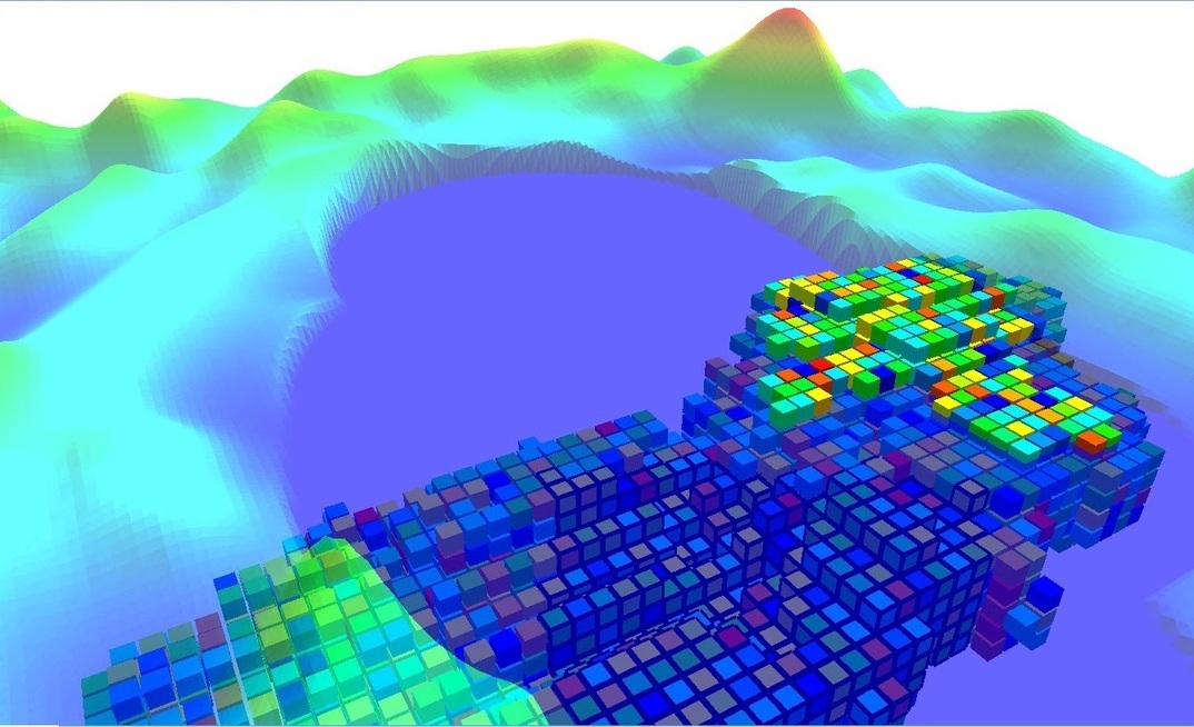
A fully-integrated data analysis software platform providing users with cutting-edge statistical, graphing and 3D visualisation, X10-Geo brings a unique approach to spatial data analytics and especially data derived from geological drilling, block models and other 3D spatial datasets.
Underpinning de Bruin's former employer, Snowden's, Supervisor geostatistics software, and in its own right, Phinar's original X10 platform is being used by a number of the world's top-10 miners and consultants, and by many others on a Phinar customer list of 150 that includes Rio Tinto, Vale, Glencore, Kinross Gold, SRK, Golder Associates and AMC Consultants.
de Bruin says Phinar set out to create an "an open, extendable" data analysis platform for exploration and mining companies that didn't come with decades of development legacy issues - "baggage" - built into the general mine planning (GMP) software suites on the market.
He describes X10 as "an extendable rapid-application development software platform for professional, technical applications … with a powerful, high-performance data layer able to seamlessly integrate the applications of different vendors" that's "ideal as a front-end for distributed computing".
X10-Geo combines the X10 platform with an extensive 3D visualisation toolbox.
X10-Geo Analytics then adds the power of a V8 analysis engine for dynamic, high-speed data analytics and statistical analysis of multi-element, multi-domain geological and resource data.
And newer X10-Workflow technology allows users to create repeatable dynamic workflows incorporating their own, or third-party, algorithms that can be run distributed in the cloud. The workflows automate the flow of employee tasks and activities, and integrate with the analytics and 3D, reducing process completion times and error rates, and improving compliance.
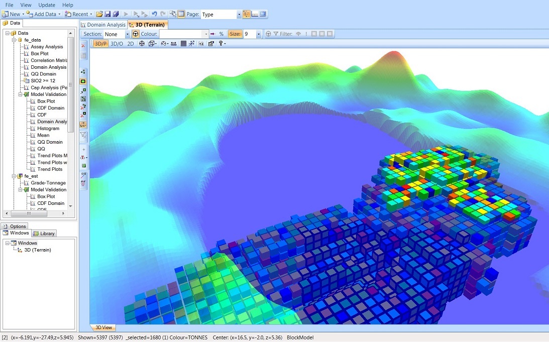
X10-Geo quickly turns spatial data into high-value insights
"Workflow automation makes processes more efficient, compliant, agile and visible by ensuring that every step of a process is explicitly defined, monitored over time, and optimised for maximum productivity," de Bruin says.
He says the integration and dynamic nature of all these parts provides the real and unique power of the X10-Geo platform.
"X10-Geo rapidly turns spatial data into high-value insights," de Bruin says.
"It has shown it can slash typical resource report preparation times by up to 90%."
One mining project evaluation manager said X10-Geo cut his exploratory data analysis from 2-3 weeks to 2-3 days.
A North American resource geologist with a leading mid-tier gold company said he would buy X10-Geo "with my own money" if his company didn't want to pay for it. Another resource geo with a big US-based consulting firm said copy-pasting of data, and mistake-prone tools such as Excel, had become (bad) memories. "X10-Geo has become indispensable for our mineral resource estimation," he said.
SRK Consulting in the US has adopted X10-Geo as its standard for resource estimation, fully integrating the product into its resource geology group workflow. A spokesperson for the major global consultancy said X10-Geo provided easy-to-use templates for EDA and model validation.
"It offers speed, flexibility and functionality for statistical analysis that most mining packages don't have. All of this allows us to focus more on the analysis and results yielding a better product for our clients."
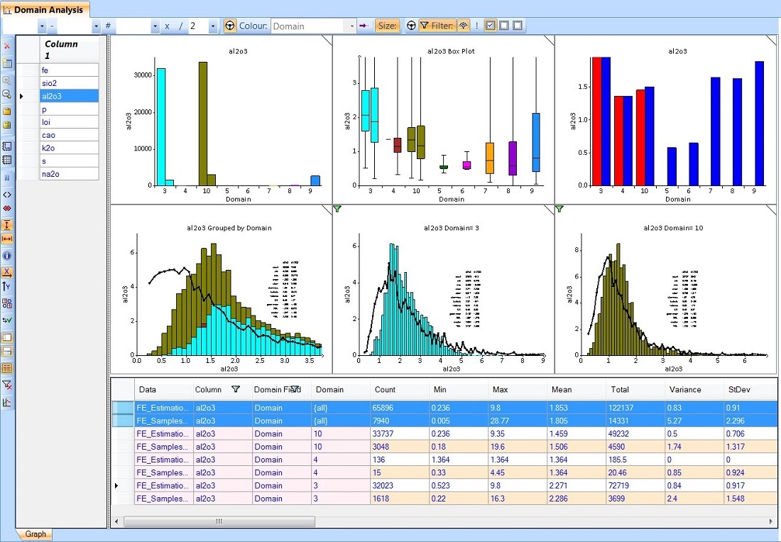
X10-Geo offers speed, flexibility and functionality for statistical analysis that most mining packages don't have
de Bruin says: "We have the tools to enable people to run algorithms, over the cloud - any number at the same time - and be able to rapidly see how the results affect their work or operating parameters. X10-Geo gives you a much better understanding of the parameters you need to use to get an optimum result.
"Next we will add the algorithms for estimation, simulation [and] optimisation … and we have X10-Geo V2 coming out later this year which will be another big step forward in how data can be grouped, compared and visualised, adding significantly more value for our users."
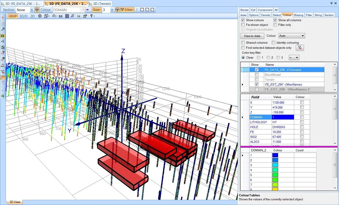
'X10-Geo gives you a much better understanding of the parameters you need to use to get an optimum result'
Global support
While the robustness of the software plus Phinar's high-level documentation and tutorials were conceived to minimise X10-Geo's support requirements, the company does pride itself on its fast, comprehensive customer engagement - with results measured in part by the volume and quality of testimonials received.
de Bruin says the company has also managed to build its biggest markets in the Americas - a long way from Phinar's Western Australia base.
Clearly, this is also a reflection of the uniqueness of the products brought to market so far.
"I love data, and new ways of visualising data," says de Bruin.
"A lot of our customers were still using Excel to do that. Of course Excel doesn't have any 3D interface; you have data copy-and-paste issues, especially with large data sets. Many users are basically sitting at that level with all the big GMPs.
"For them it's generally not a focus.
"Our aim has been to make sure that we are by far the best at that level, and to do stuff that no-one else can do. And then allow for more specialised algorithms, proprietary or otherwise, to slot straight in.
"The 3D integration and visualisation of data - graphs, statistics - can be achieved quickly … immediately, which is something the industry has waited a long time for.
"With the customer base built so far, and the new tools coming out, we think we're in quite a good position to accelerate over the next 2-3 years."


